

Rough Waters
- cmw2559
- Sep 10
- 3 min read
Updated: Sep 12
The distance from Montauk to Ocean City, Maryland is about 210 nautical miles. At 20 knots, that's about 10.5 hours of motoring. Brio left Montauk at 6:45 am. Could anything go wrong?
Crossing the New York Bight means going offshore into the Atlantic Ocean. You can see that we stayed on the Continental Shelf for the entire crossing. About 40% into the trip, we go over a canyon, which may just be a stream valley cut into the Shelf during immediate post-glacial times.
Interestingly, drill cores of the Shelf near its boundary with the Continental Slope shows rhododendron seeds in the core at about the time of the glacial maximum perhaps 20,000 years ago. As the ice advanced during glacial times, plant life "migrated" in front of the ice and moved south to the edge of the Shelf. Ocean water levels were perhaps 200 feet lower, so much of the Shelf was exposed to the air.

Ocean City, Maryland is located on the Maryland coast where the "Finish" flag is located.
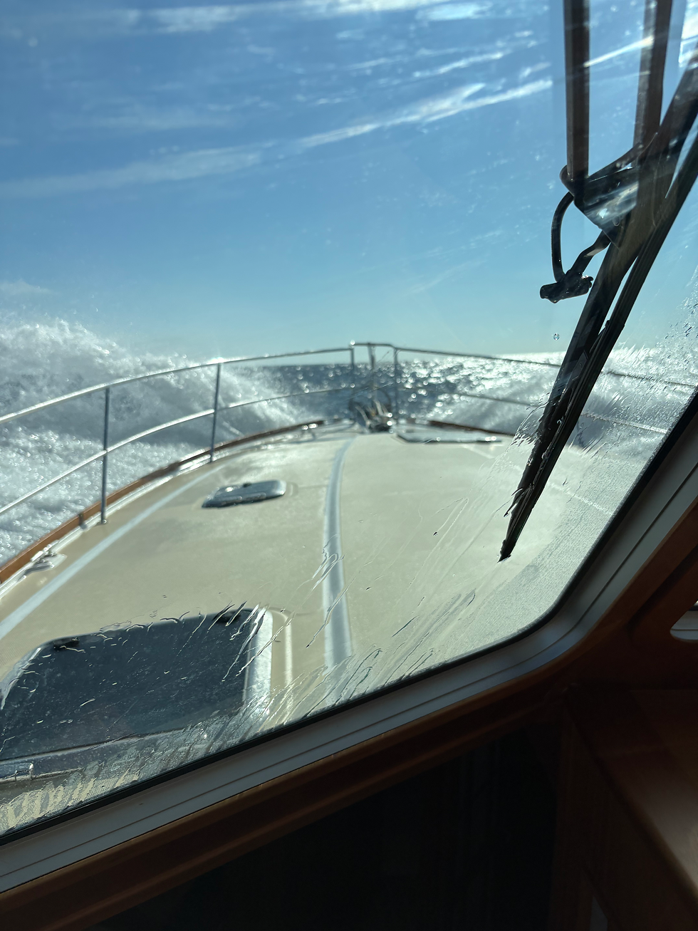
As the trip progressed, we moved away from the shelter of Long Island. The waves built as the northeast wind became more established. Wave heights started at perhaps 2 to 3 feet and were 5 to 6 feet by the end of the trip. Wind speeds rose from about 10 to 15 knots to 20 to 25 knots by the end of the day.
A view towards the bow around mid-day.
And a view to the stern at the same time.

At about the time of these photos, the port engine stalled. We switched the port fuel filters from the outboard filter to the inboard filter, primed the fuel system to get rid of any trapped air and started the engine. It ran flawlessly for the rest of the trip.
About four hours later, off the southern New Jersey coast, the starboard engine stalled. The filter was switched to the inboard filter, but it would still not start. We then limped into Ocean City for the next 85 miles on one engine.
Due to these complications, our progress slowed. Instead of arriving at the entrance to the Ocean City harbor before sunset with both engines operating, we arrived at 8:30 p.m., after dark under one engine. The northeast winds were blowing 20 knots and the following seas were six feet high. We were traveling more slowly, which made Brio more manageable.
We felt our way into the harbor, following a serpentine route as we obeyed the buoys. Each buoy had its characteristic flashing light, the nuns with red flashing lights and the cans with green flashing lights. Fortunately, the GPS charts provided a map by which we could safely navigate into the harbor.
The GPS chart system has embedded photos of the harbor entrance as well as the marina where we had to dock with one engine. That gave us some familiarity with what lay ahead. Thank goodness.
Once we made our way into the harbor to the marina, we started our approach to the dock with one engine. After several tries, we were able to get a line on one of the dock's pilings. We could then pull Brio alongside the dock and tie her up. We then plugged her in and ate a snack and went to bed.
We slept well!
Cheers,
Brio


Comments