

The Swirling Nor'easter
- cmw2559
- Sep 17, 2025
- 4 min read
After leaving Yorktown, we headed north, up the Chesapeake Bay. We knew the weather was changing. We had enjoyed a beautiful weekend visiting historical site, so things were going to go downhill. In fact, the morning sky was crimson, reminding us of "red sky at morn, sailor take warn." We wanted to anchor for the night, so we looked for a "hurricane hole" that would protect us that night. Only after we had committed to this "hole" did we realize that a significant nor'easter was developing of the North Carolina Outer Banks and then move north and west into Chesapeake Bay.
Here's the sunset photo from Sunday night. The storm was still gathering force offshore.

But you can see the mottled clouds indicating a change in the weather with rain arriving in the next 24 to 36 hours. Here was the forecast:

Those projected wave forecasts were "only" 7 to 10 feet on the ocean. We were motoring into Chesapeake Bay around where the P and E of Cape Charles is placed. By mid-day Monday, we had waves that were building, but were only 3feet and coming from the north.
We decided to head into Mobjack Bay, a place we knew was beautiful and remote. We had also heard that there were many small coves and "holes" that would give us protection given what was developing aloft.
We came out of the York River, which is the lower river on this chart. This meant motoring into increasing chop until we could finally clear the beacon above "13". Then we could motor north north west to Mobjack Bay and into the Est River.

We traveled up the East River to Put In Creek, which you can trace by the dashed "snail trail." But by mid-afternoon on Monday, we could tell that anchoring in Put In Creek would put us in a wind tunnel of northeast wind coming down the Creek towards us. We wanted something more sheltered.
So we moved further up the East River to the green anchor and nestled in under the lee shore, protected from the direct winds coming from the nor-easter. By now, it was getting late in the afternoon. We anchored and put out some chain, but not enough to account for a still-rising tide and the rain-swollen river that developed the next day.

Here are the trees along the shore to our northeast. These would help break the growing winds.

The view to our stern showed still waters, but scudding skies. The point of trees to the right became our source of refuge after the storm had passed.

At least someone remained majestic.
That Monday night the rains started.

This is what was winding up over us. The eye of this nor'easter was in fact a little more to the west. It made landfall on the tip of the Delmarva Peninsula Tuesday. Northeast winds in the Bay where we had just traversed a few hours before increased to 20 - 30 knots with gusts up to 40 knots. Waves were 7 feet in the Bay, coming from the north. We were grateful we were in one of the holes, waiting for the storm to pass.
As the tide and storm waters rose on Tuesday, our anchor began to drag. We were dragging down on a nearby dock. Fortunately, the rain had let up and so we raised the anchor, morored upwind towards another dock, dropped the anchor and fell back to the southwest, pushed by the northeast wind.
The rains started in again. They were tropical, dropping sheets of wet. At times, the sheets moved horizontally. Brio strained at her anchor, yawing from side to side like some harnessed mare. The anchor chain would strain in its roller, then ease, then strain, each time making a clunking sound.
All held and we were safe. Around 3 am on Wednesday morning, the storm winds subsided. Waves dropped to 5 feet, then 4, then 3 then 2 feet high in the Bay. The eye of the storm went right over us around 3:30 and everything was still.
Then the winds reversed and started blowing mildly from the southwest. Brio circled her anchor and now was set with her bow pointing southwest instead of northeast. The anchor reset, but now we were increasingly close to the other dock. By 5:30 am, we decided to move again, this time to the lee of the point in the picture above.

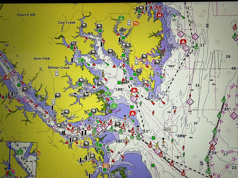
After breakfast, we headed out of the East River into Mobjack Bay's much calmer waters. Then we turned north, up the Chesapeake Bay to the Rappahannock River and up the Carrotomon River where the boat image sits in this picture, near Kilmarnock.

The Yankee Point Marina is quaint and remote, as you can see in this photo. We plan to go to The Black Duck tonight for dinner.
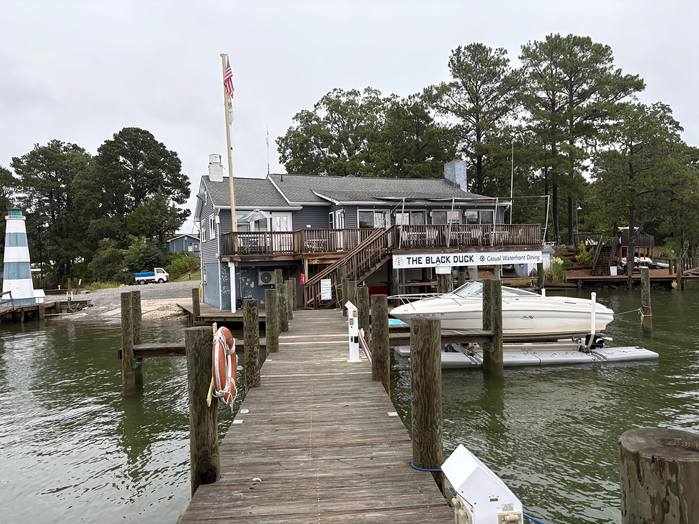
Compared to the past two days at anchor, this is a chance for a peaceful night and hot showers and a good meal!
Cheers,
Brio


Comments